In the next week or two, the NSW government will reveal how many floodplain harvesting licences it intends to grant in the Gwydir valley, home to some of the biggest cotton producers in the country.
It’s the next chapter in a process that will grant between $2bn and $4bn in water entitlements to farmers as part of a plan to control and regularise a practice that captures billions of litres of water for irrigation during high-rainfall events.
The NSW government started with the much smaller border rivers region in the far north of the state, and that has been controversial enough.
But the Gwydir will be the real test of the government’s plan and its commitment to restoring environmental flows while also continuing to allow farmers to harvest intermittent flood waters.
The licensing process is one of the last big pieces – and possibly the hardest part – of the implementation of the Murray Darling Basin plan.
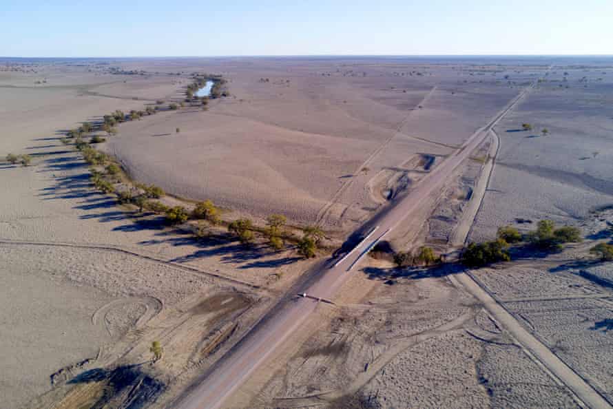
Over the past three decades, there has been a proliferation of vast water storages – mainly in western NSW and capable of holding billions of litres of water – being used to grow crops on cotton and wheat properties.

As rainwater moves across these flat expanses, engineered structures such as access roads, channels and levee banks are used to direct it into storages. In the past it would have replenished wetlands, flowed downstream or soaked into aquifers.
Many structures have been built without approval, leading some critics to call the practice “water squatting”.
The NSW government is in the final stages of trying to license this form of water so it can be properly monitored, measured and policed. It wants to have licences issued by July.
Sounds like a sensible idea, right?
But like all water policy, the licensing is highly contentious, mainly because of inadequate data about how much is being taken and the science surrounding the impact of the practice.
The licensing of floodplain harvesting is focused on five valleys: the border rivers, the Gwydir, the Namoi, the Barwon-Darling, and the Macquarie.
The idea is to return to 1993-94 levels of floodplain harvesting, and only structures built before 2008 will be licensed.
The NSW Natural Resources Access Regulator has been visiting farms throughout these areas, verifying how big the storages are and what is eligible for licensing.
It says there are 373 storages greater than 1,000ML (more than 400 Olympic swimming pools) and 693 that are less than 1,000ML.
Eligible farmers must apply to a committee to have their floodplain harvesting structures authorised and to receive floodplain water entitlements. They will be expected to meter the amount of floodplain runoff being taken.

So far, the NSW Department of Primary Industries has released documentation on the border rivers region. About 38 gigalitres of water will be licensed, which is less than a quarter of the total storage in the region (storages can be used for other entitlements, such as extraction of river water).
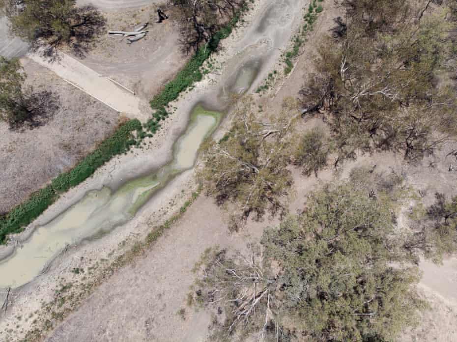
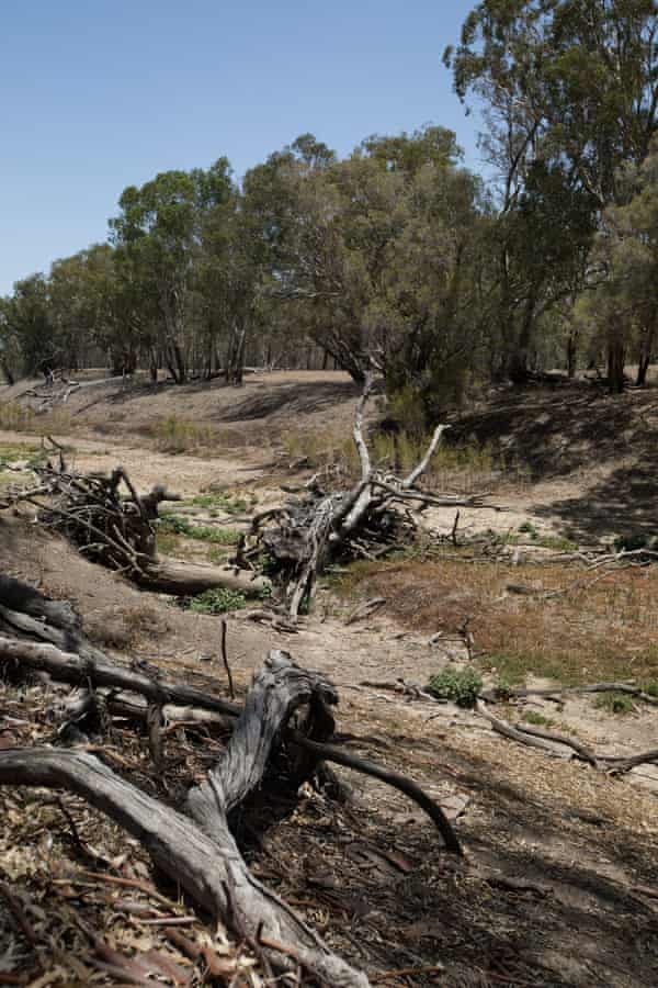
Floodplain harvesting is thought to have contributed to declining flows into the Murray-Darling system and increased prolonged dry periods.
A report by the Wentworth Group of Concerned Scientists, published in September, found significant discrepancies between how much water one would expect to find in the river, and how much was actually there based on hydrological modelling and expected flows under the basin plan. It found that 20% of the water expected under the basin plan at wetlands listed under the Ramsar convention did not arrive.
The department says its border rivers plan will result in a 13% reduction in the volume of water being taken. It argues it will result in significant environmental improvements in wetlands, which will benefit water bird populations and native fish.
But others are less sure, arguing that the hydrological models used to estimate overall water extractions in a catchment, and to determine compliance with extraction limits, are prone to errors, especially in the northern Murray Darling basin.
Emma Carmody, managing lawyer of the Environmental Defenders Office’s freshwater program, says licensing floodplain harvesting could lead to a reduction in the practice, but without a solid understanding of how much water has been taken before the licences come into force, it will be hard to be sure.
“This lack of robust data may result in too much water being licensed in a catchment relative to actual water availability for all users and the environment,” Carmody says.
“If overlicensing remains undetected and/or unaddressed, it will invariably affect water access by other licence holders and/or the environment. For example, it could result in annual allocations for other entitlement holders being diminished to accommodate floodplain harvesting,” she says.
“We’re concerned that the result will be two teaspoons of water being returned to the environment instead of one,” Carmody says.
In the face of enormous scepticism from scientists and farmers, the government asked water consultant Tony Weber from Alluvium to review its modelling and the data it had on floodplain harvesting.
The final report in July 2019 concluded: “The determination of floodplain harvesting volumes is, in effect, a determination by difference. That is, there are a number of ‘points of truth’ that indicate volumetric flows and consumption in a particular river reach, but floodplain volumes, including floodplain harvesting volumes, in themselves have not been directly measured.”
The review found there was “no cross-verification of the volumes” other than through the modelling.
It found that “the justification and evidence provided around the use of the adopted parameters and model for rainfall-runoff is very limited”.
The reviewers said they were “unwilling to agree to the current method of accounting for rainfall-runoff until further considerations are undertaken”.
But in November the reviewers signed off on the public documentation for floodplain licences in the border rivers, saying the documents fairly represented the “state of play” on modelling for floodplain harvesting in that region.
Adding to the downstream concerns is the extremely intermittent nature of floodplain water. It might only be available every five or so years. Under the plan, if farmers have credits in their water account, they can take 500% of their allowance in any one year. Downstream farmers fear that this could effectively stop water reaching the rivers.
The big test is coming with the Gwydir valley, centred on Moree.
It includes huge agribusinesses, such as Auscott, a US owned cotton company, Australian Food and Fibre, owned by Joe Robinson, who has strong National party connections, and several other large family-owned farming enterprises which often comprise several properties.
Getting it wrong will come at a high environmental price and potentially a big cost to the NSW government if it is forced to buy back licences in the future.
There are other unknowns. One is climate change, which was not accounted for in the hydrological modelling.
Another is how the government can ensure that floodplain infrastructure that is not licensed as a result of this process is decommissioned. In some cases it might be a matter of knocking a hole in a levee bank so the dam no longer holds back flood waters. But in some cases it could involve access to roads and channels, which may not be so simple.
The government says it is developing plans to monitor decommissioning once licences are granted.
Then there is the question of trading floodplain harvesting licences. Sceptics ask how can a licence that requires a structure on the land to harvest flood waters can be traded.
According to the NSW government, farmers selling floodplain harvesting entitlements will need to modify works on their farms, such as removing a levee, in order to trade the water.
The purchaser will need to have works approved for floodplain harvesting before taking water under the purchased licence.
The NSW Labor spokesperson on water, Clayton Barr, has suggested that the government should grant licences only for a limited period, such as five years, to make sure the amount of water taken is sustainable.
He says he has floated the idea with key stakeholder groups and is happy to discuss it with the water minister, Melinda Pavey.
“If we don’t know what the implications will be, why would we give farmers an asset now? The NSW taxpayer might have to buy it back in coming years at an unknown cost,” he says.
The department says the scheme already has some flexibility because the share of water allocated to each licence can be adjusted.
The government is expected to reveal more detail about floodplain harvesting in the Gwydir and the licences when parliament resumes on 9 February.
It will also table a regulation that aims to outline more detail about how the licences will work, while legalising the taking of flood water until the licences come into force on 1 July.
But that could ignite a new stoush. The last regulation was disallowed by the minor parties, which do not trust the government’s motives for trying to legalise the practice before the licences come into force.
Water consultant Maryanne Slattery predicts trouble.
“Whichever way you look at it, it’s going to be a shitshow.”